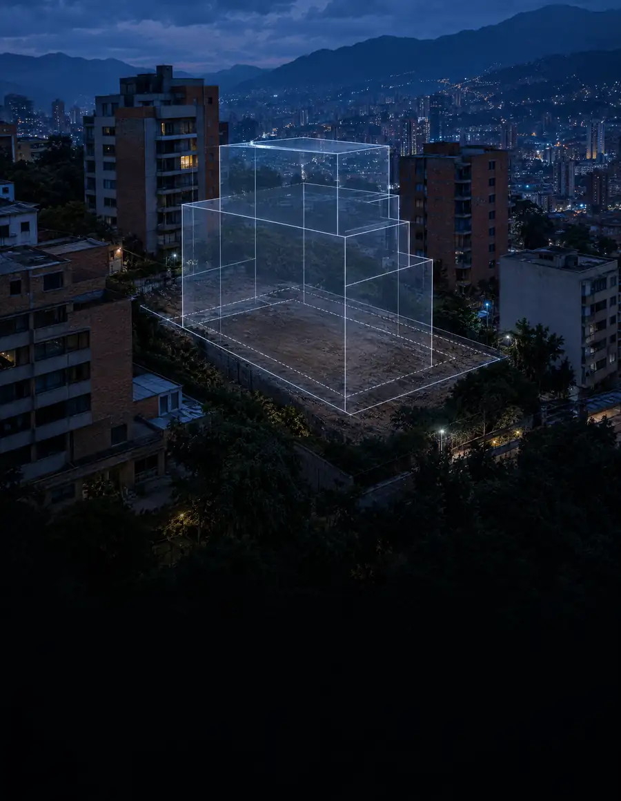
Zoning analysis of the property development potential and feasibility
Every real estate investment begins with a decision: can the project I have in mind actually be built here? Before you design, know exactly what you can build.
Request a consultationBefore you design
Know exactly what you can build
At KAMON & CO. we carry out the technical and urban planning analysis of the property to identify the regulations that govern its development, so you know the true building potential of the land before investing in designs, specialist studies or permitting. Designing without knowing the planning restrictions can lead to costly redesigns, permitting delays and even make the proposal impossible to build. Our aim is to reduce uncertainty, minimize risk and provide clear information for decisions backed by technical criteria.
Illustrative exercise
From index to volume
Move the indices and the height: the maximum volume rises on the lot and the piece shows which parameter limits it. Lot, setbacks and indices are illustrative; the actual values are set by each municipality’s Land Use Plan (POT) for each property.
- Lot area
- 600 m²
- Footprint
- 352 m²
- Floors
- 5
- Built area
- 1.760 m²
Footprint limited by the setbacks. Height limited by IC.
Scope
What do we analyze?
- 01
Use and development rights
- Land use
- Planning treatment and development rights
- Permitted density
- 02
Indices and heights
- Site coverage ratio (IO)
- Floor area ratio (IC)
- Maximum permitted height
- Number of permitted floors
- 03
Site layout
- Mandatory setbacks
- Required parking
- 04
Restrictions
- Environmental and heritage restrictions
- Infrastructure easements
- Protected areas
12
Planning parameters reviewed for every property, according to the municipal Land Use Plan (POT) and the information available.
Advantages
Why analyze your property with ?
Real potential
Understand the development potential of the land before investing and make the most of the lot.
Lower risk
Avoid projects that conflict with regulations and reduce technical and financial risk.
Technical interpretation
A technical approach based on interpreting planning regulations, in clear, decision-oriented reports.
A basis for design
A technical basis for design and permitting, integrated with BIM workflows for the stages that follow.
Nationwide coverage
Personal attention for owners, companies and investors, working 100 % remotely across Colombia.
Applications
Who is it for?
- 01Engineers
- 02Architects
- 03Contractors
- 04Landowners
- 05Prospective buyers
- 06Real estate investors
- 07Real estate developers
- 08Real estate agencies
- 09Public and private organizations
Process
Our methodology
- Step 01Property data
- Step 02Applicable code
- Step 03Parameters
- Step 04Restrictions
- Step 05Feasibility
- Step 06Recommendations
- Step 07PDF report
Frequently asked questions
Does this service guarantee my project will be approved?
No. The analysis identifies the planning conditions that apply to the property, but project approval rests with the competent authorities.
Is it useful for assessing a lot before buying it?
Yes. It is one of the main uses of the service: many plots look attractive for their location or price, but their planning conditions can limit what can be built. The analysis reveals the building potential and the restrictions before you invest.
Which documents do I need to start?
Whatever is available: property address, property registration number (when applicable), cadastral record, lot plan, topographic survey (if any), deed or certificate of title (when needed) and any other relevant information.
What do I receive at the end?
Depending on the scope: a technical zoning report, a summary table of planning parameters, a technical interpretation of the applicable regulations, the property’s restrictions and opportunities, a preliminary feasibility opinion and recommendations for the architectural design, in PDF.
How long does the analysis take?
The timeline depends on the size of the property and the information available, or on the date the client needs: we assess the scope and confirm in the quote whether it can be met. We reply to every inquiry in under 24 business hours, and the formal quote takes 1 to 2 business weeks from the moment we receive the complete information.
Can I request this service from any city in Colombia?
Yes. We work nationwide and, in most cases, the service can be carried out entirely remotely. The scope depends on the municipality and the information available.
Does the study include design recommendations?
Yes. When the scope allows, the report includes technical recommendations that can serve as a basis for the architectural project.
Does this service replace a planning permit?
No. It is a technical study that supports project planning. Permits and authorizations must be obtained from the competent authorities.
Do you sign confidentiality agreements?
Yes. When the project requires it, we sign a non-disclosure agreement (NDA) before receiving any information about the property.
What comes after the zoning analysis?
With this information you can move forward with greater certainty into architectural design, BIM modeling, technical documentation and permitting.